• Home
  • About
    • Our Story
    • Our Team
    • Our Projects
    • Our Supporters
  • Blog
  • Explore Kapan
    • Getting There
  • Tours
    • Take the Adventure
  • Tatev - Khustup Hiking Trails
    • General Guide
    • Flora & Fauna
    • Tatev - Tandzaver
    • Tandzaver - Antarashat
    • Antarashat - Arajadzor
    • Arajadzor - Shgharshik
    • Shgharshik - Vahanavank
    • Vahanavank - Bekh
    • Bekh - Bekh Anapat
    • Bekh Anapat - Vachagan
    • Vachagan - Baghaburj
    • Baghaburj - Khustup
  • Other Hiking Trails
    • Bardzraven - Tandzaver
    • Tandzaver - Verin Khotanan
    • Verin Khotanan - Tavrus
    • Verin Khotanan - Shrvenants
    • Dacha Trails (Arevashat)
    • Voghji Valley
    • Mount Khustup
  • Social Enterprise
  • Get Involved
    • Volunteer
    • Donate
  • На русском
  • ARK Ecological NGO
  • Home
  • About
    • Our Story
    • Our Team
    • Our Projects
    • Our Supporters
  • Blog
  • Explore Kapan
    • Getting There
  • Tours
    • Take the Adventure
  • Tatev - Khustup Hiking Trails
    • General Guide
    • Flora & Fauna
    • Tatev - Tandzaver
    • Tandzaver - Antarashat
    • Antarashat - Arajadzor
    • Arajadzor - Shgharshik
    • Shgharshik - Vahanavank
    • Vahanavank - Bekh
    • Bekh - Bekh Anapat
    • Bekh Anapat - Vachagan
    • Vachagan - Baghaburj
    • Baghaburj - Khustup
  • Other Hiking Trails
    • Bardzraven - Tandzaver
    • Tandzaver - Verin Khotanan
    • Verin Khotanan - Tavrus
    • Verin Khotanan - Shrvenants
    • Dacha Trails (Arevashat)
    • Voghji Valley
    • Mount Khustup
  • Social Enterprise
  • Get Involved
    • Volunteer
    • Donate
  • На русском
  • ARK Ecological NGO
  ARK Armenia

Section five|shhgarshik - vahanavank

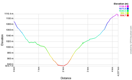
4.2 km  |  1 hours  | Easy

Picture
DOWNLOAD GPX MAP
Picture
DOWNLOAD ROUTE DESCRIPTION
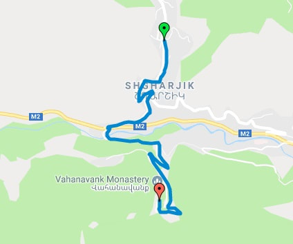
This short junction is a necessary connection between the trails on the left and right banks of the river Voghchi. The trail leads from the village of Shxarshik, across the valley, to the Vahanavank monastery on the opposite side. For more long-distance hikers, this section can be completed in combination with ones before and after.
Picture
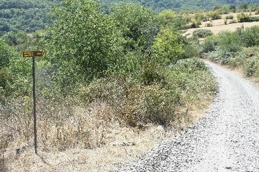
It begins on a gravel path for cars, as indicated by the sign. When you reach the main road at the bottom of the valley, turn left, walk for 30 meters before turning right on the paved road leading up to Vahanavank.
Picture
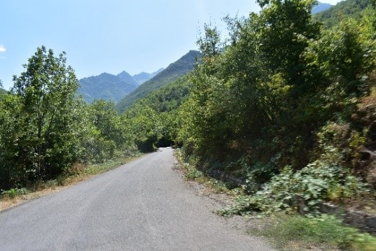
It is mostly free from traffic and takes about 25 minutes.
Picture
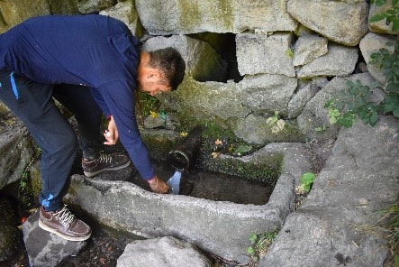
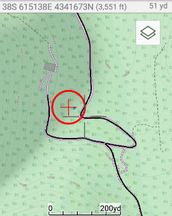
On the turn just before u reach the monastery there is a fresh water source hidden in the trees, as shown on the map. 300m before the monastery is a big space on left where people have picnics. It is also possible to camp here, but can get busy during summer weekends. ​
Picture
Picture
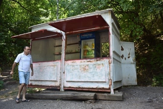
There is also a shop nearby that sells refreshments. Open at irregular hours. 
Picture
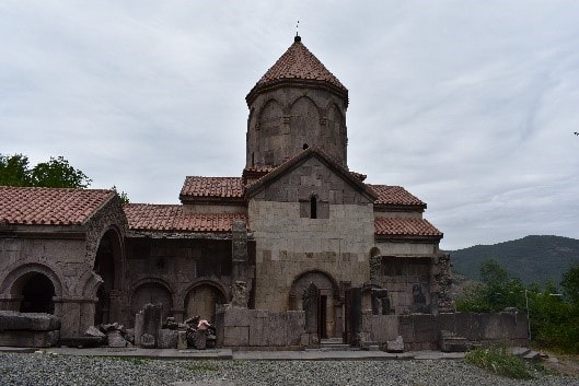
You then reach the monastic complex Vanavank, about which you can find more information at the start of the following section.
 
Coming closer to the monastery, you will see signs going left, which marks the start of the next section, number 6, of the trail. The monastery itself 200m up the road.​
Powered by Create your own unique website with customizable templates.