15 km | 6 hours | Medium-Hard
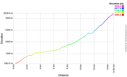
The final leg of the trail from Baghaburj, goes via the village of Storot (also known as Nafcha), before reaching the ending of the trail mount Khustup. It is possible to do this in one day, but we recommend taking two, staying overnight in Nafcha basecamp. Mount Khustup is the most beautiful summit of the Kapan region at 3,206 meters. Since ancient times the mountain has been a place of prayers and pilgrimage. The origin of Vachagan River is located at the northern edge of mount Khustup. Its difficulty has been marked as ‘medium-hard’ because it is necessary to carry food and equipment if planning to camp, and there is a final section of the mountain where you need to climb up a small rock face.
|
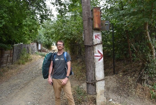
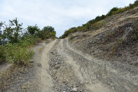
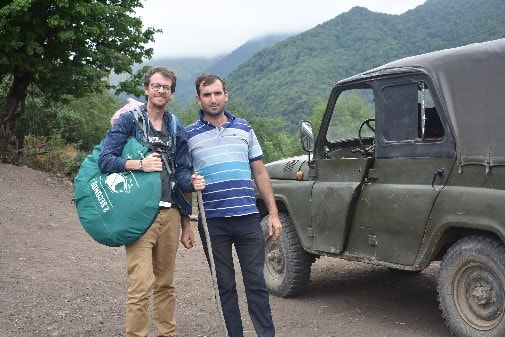
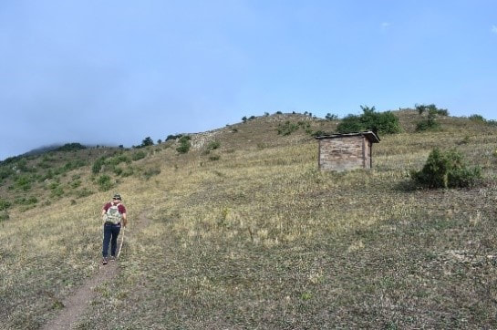
The journey begins from the upper part of Baghaburj with a climb on a dusty gravel road, keeping Kapan behind you.
|
|
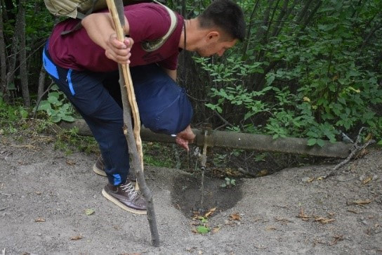
After about an hour you can see airport that is being reconstructed from Soviet times. Can see to the right a view of mount Pela (meaning big ear in Armenian). The first water source is about 2km from the village on the left-hand side.
|
|
About an hour into the hike there is another water source on the right.
|
|
After another hour, you pass the house of local farmer Ando. He does not formally run as a guesthouse, but is happy to offer guests shelter for the night. They just live there six months a year in summer.
|
|
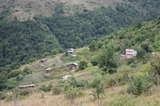
After three hours you reach the shepherd’s settlement of Navcha at 2000 meters, which has only seven families living there in during the summer.
|
|
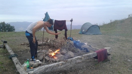
There is a place for camping at the top. Exposed so you will need an appropriate sleeping bag. A recommended place for gathering firewood is alongside the path leading into the village. There is a fresh water tap close to the nearest house. This family are happy for you to leave your equipment in their yard while hiking up to the summit.
|
|
From base camp you begin the climb up the mountain to the right.
|
|
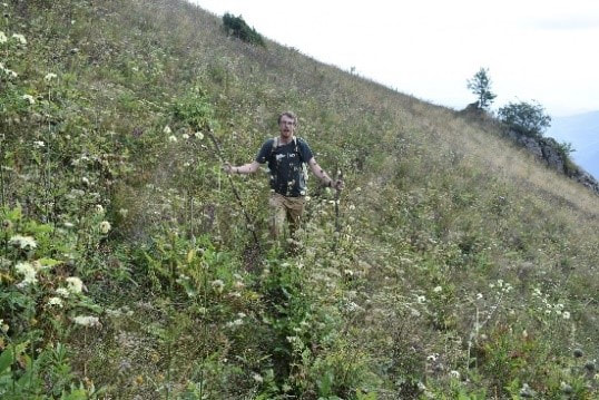
About 20 mins into the hike the grass is very overgrown so keep an eye out for trail markings
|
|
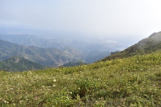
The mountain is covered with alpine meadows and on the north eastern slopes it is covered with forests. It is made of volcanic stones and sedimentary rock. The slopes are fragmented and there are caves and cliffs. Hundreds of streams and rivers flow from melted snow on the mountain, from which originates the Vachagan river. There is a fresh water tap about halfway up the climb on the right.
|
|
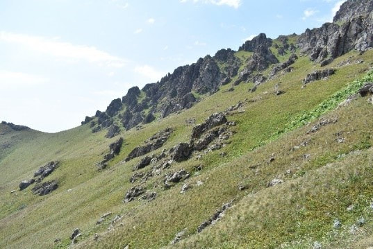
The path remains grassy to the top as rocks start to poke out. The path zig-zags up the hill to a dip on the left, before making a direct route to the main summit on the right.
|
|
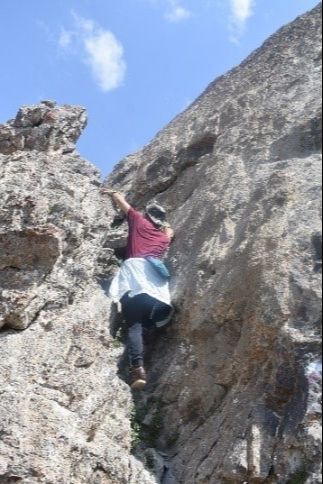
On route to the top, there are a couple of sections where it is necessary to climb up an easy rock face.
|
|
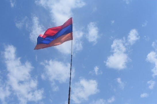
Congratulations. You have reached the summit of 3,200 meters. It is said that you can see five ‘countries’ from the top: Armenia, Turkey, Iran, Azerbaijan and Karabakh.
We hope you have enjoyed the trail. See the Ark Armenia website for additional hiking options in the region. |
Acknowledgements
This segment was first scouted by ARK volunteers with the financial support of Tatiana Kuznetsova
