• Home
  • About
    • Our Story
    • Our Team
    • Our Projects
    • Our Supporters
  • Blog
  • Explore Kapan
    • Getting There
  • Tours
    • Take the Adventure
  • Tatev - Khustup Hiking Trails
    • General Guide
    • Flora & Fauna
    • Tatev - Tandzaver
    • Tandzaver - Antarashat
    • Antarashat - Arajadzor
    • Arajadzor - Shgharshik
    • Shgharshik - Vahanavank
    • Vahanavank - Bekh
    • Bekh - Bekh Anapat
    • Bekh Anapat - Vachagan
    • Vachagan - Baghaburj
    • Baghaburj - Khustup
  • Other Hiking Trails
    • Bardzraven - Tandzaver
    • Tandzaver - Verin Khotanan
    • Verin Khotanan - Tavrus
    • Verin Khotanan - Shrvenants
    • Dacha Trails (Arevashat)
    • Voghji Valley
    • Mount Khustup
  • Social Enterprise
  • Get Involved
    • Volunteer
    • Donate
  • На русском
  • ARK Ecological NGO
  • Home
  • About
    • Our Story
    • Our Team
    • Our Projects
    • Our Supporters
  • Blog
  • Explore Kapan
    • Getting There
  • Tours
    • Take the Adventure
  • Tatev - Khustup Hiking Trails
    • General Guide
    • Flora & Fauna
    • Tatev - Tandzaver
    • Tandzaver - Antarashat
    • Antarashat - Arajadzor
    • Arajadzor - Shgharshik
    • Shgharshik - Vahanavank
    • Vahanavank - Bekh
    • Bekh - Bekh Anapat
    • Bekh Anapat - Vachagan
    • Vachagan - Baghaburj
    • Baghaburj - Khustup
  • Other Hiking Trails
    • Bardzraven - Tandzaver
    • Tandzaver - Verin Khotanan
    • Verin Khotanan - Tavrus
    • Verin Khotanan - Shrvenants
    • Dacha Trails (Arevashat)
    • Voghji Valley
    • Mount Khustup
  • Social Enterprise
  • Get Involved
    • Volunteer
    • Donate
  • На русском
  • ARK Ecological NGO
  ARK Armenia

Section eight|Bekh Anapat - vachagan

3.8 km  |  2.5 hours  | Easy

Picture
DOWNLOAD GPX MAP
Picture
DOWNLOAD ROUTE DESCRIPTION
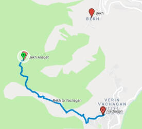
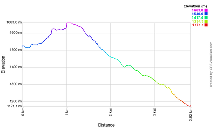
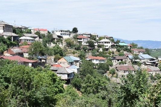
This section of the trail leads up from the Bekh Napat monastery and then leads into the village of Vachagan, located approximately 5 km south of Kapan on the altitude of about 1200 meters. As with the previous segment, the first (ascent) is almost entirely located in the forest.
Picture
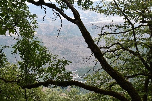
From the monastery, the forested path follows the mountain around to the right. There is a climb of about 1 hour. Along the path you can get glimpses through the trees of Vachagan below in the valley to your left.​
Picture
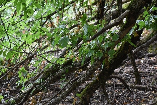
About 15 minutes up the hill after the monastery there are a number of fallen tree blocking the path. It is possible to squeeze under or navigate around up the hill. 
Picture
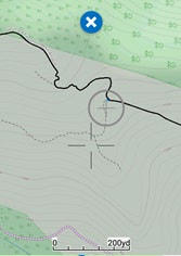
The gradual descent down the mountain is well signposted. After passing a large field on your left with three structures covered in tarpaulin, be sure to turn left and not stray onto other paths that go straight on, as shown in the screenshot.
Picture
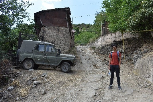
After another 30 minutes you arrive at a dirt road that leads you into the village of Vachagan – you should go left.
​
On your right you will see a beautiful high cliff, and Khustup in the distance.
Picture
Here you can visit the Surb Astvatsatsin Church.

There is currently nowhere to stay, but you can take a taxi to Kapan for 1000 dram.

There is a small shop in the village offering supplies.
​
A water source can be found on path leading out of town.


Powered by Create your own unique website with customizable templates.